


Tropical Depression Crising to Intensify, Poses Threat to North Luzon
Tropical Depression Crising is forecasted to strengthen into a storm and potentially reach severe tropical storm status before nearing northern Luzon. The storm may impact mainland Cagayan or Babuyan Islands by Friday evening to early Saturday morning before moving northwestward and exiting the Philippine area of responsibility by Saturday afternoon or evening.
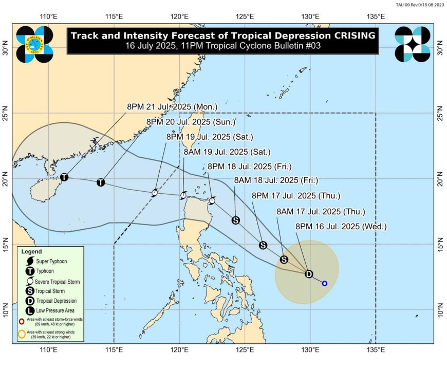
Tropical Depression Crising is forecasted to intensify into a storm by Thursday morning and potentially reach severe tropical storm status by Friday afternoon or evening as it nears northern Luzon.
In its 5 p.m. update on Wednesday, the Philippine Atmospheric, Geophysical and Astronomical Services Administration (Pagasa) reported that Crising was situated 625 kilometers east of Virac, Catanduanes.
The depression has maintained a maximum wind speed of 45 kilometers per hour (km/h) with gusts up to 55 km/h, moving west-northwestward at 20 km/h.
Pagasa mentioned that Crising could pass near or make landfall in mainland Cagayan or Babuyan Islands from Friday evening to early Saturday morning, then continue northwestward and potentially exit the Philippine area of responsibility by Saturday afternoon or evening.
No tropical cyclone wind signal has been raised yet, but Pagasa indicated the possibility of issuing TCWS No. 1 for parts of Cagayan Valley by Wednesday night or Thursday morning, and potentially for Catanduanes if Crising maintains its current trajectory or expands its coverage.
Pagasa also warned of strong gusts due to the southwest monsoon affecting various areas, including Batangas, Quezon, Bicol region, Mimaropa, Visayas, Zamboanga del Norte, Camiguin, Surigao del Norte, Dinagat Islands, Davao Occidental, and Davao Oriental on Thursday, with similar conditions expected in additional regions on Friday.
According to the source: Inquirer.net.
What's Your Reaction?
 Like
0
Like
0
 Dislike
0
Dislike
0
 Love
0
Love
0
 Funny
0
Funny
0
 Angry
0
Angry
0
 Sad
0
Sad
0
 Wow
0
Wow
0


