


Weather Alert: Thunderstorm Warning for Eight Counties in Ireland
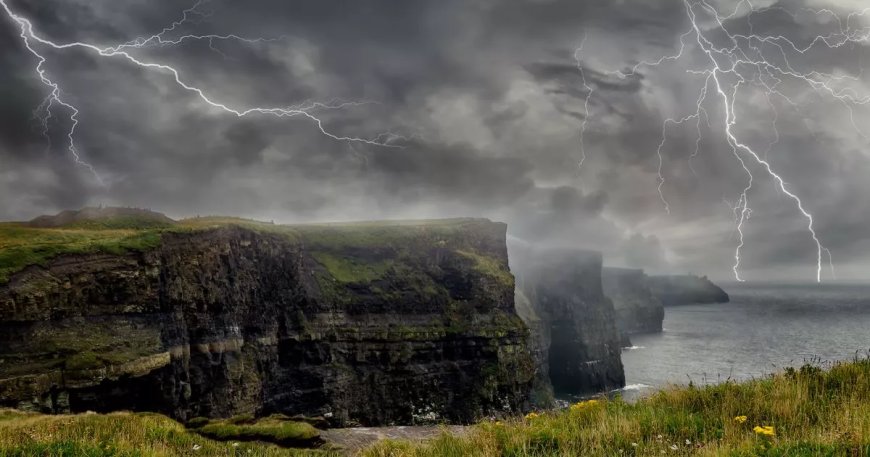
Met Éireann has issued a Status Yellow thunderstorm warning for eight counties in Ireland, including Clare, Limerick, Kerry, Galway, Leitrim, Mayo, Roscommon, and Sligo. The warning is in effect from 2pm to 10pm on Sunday, with risks of surface water flooding, lightning damage, and travel disruptions. Outdoor events may be impacted. Another high temperature warning is also in place for 17 counties. Stay updated with the Met Éireann forecast for the coming days.
Met Éireann has issued a fresh weather warning for eight counties on Sunday as a major change in conditions is set to bring a glorious weekend to a sudden halt in parts of the country.
A Status Yellow thunderstorm warning has been issued for nearly all counties on the western seaboard - Clare, Limerick, Kerry, Galway, Leitrim, Mayo, Roscommon and Sligo - which will come into effect at 2pm on Sunday and remain in place until 10pm.
The warning for later today had initially been issued to all five counties in Connacht on Saturday afternoon, with Clare, Limerick and Kerry added by Met Éireann on Sunday morning.
Affected areas are at risk of surface water flooding, lightning damage and difficult travelling conditions, while Met Éireann has warned of an impact on outdoor events at a time when there are plenty of them taking place across the country.
It is one of two weather warnings that will come into effect on Sunday, along with a high temperature warning for 17 counties - Carlow, Kildare, Kilkenny, Laois, Longford, Offaly, Westmeath, Cavan, Donegal, Clare, Limerick, Tipperary, Galway, Leitrim, Mayo, Roscommon and Sligo - that will be in place from midday until 6pm.
Those counties can expect to see highs in excess of 27C again today, with Met Éireann warning of the potential for water safety issues due to the increased use of lakes and beaches, forest fires and heat stress.
Unlike Saturday, however, when there were night-time minima temperatures in excess of 15C, the warning will not continue into Sunday night and the early hours of Monday morning.
The parts of the country not affected by the thunderstorm warning will enjoy another fine and sunny Sunday for the most part, with temperatures again hitting in the region of 30 degrees before rain begins to spread from the west late in the afternoon.
Sunday night into Monday morning will mark a significant change in the weather, with spells of rain, heavy and thundery at times, moving northwards through the country.
The week will begin generally unsettled and will feel a lot cooler than it has in recent days, although temperatures will start to rise as the week goes on, reaching highs in the early 20s.
Nearly every day will bring some amount of rain according to the Met Éireann forecast, with the unsettled spell set to last right up until next weekend.
Check out the Met Éireann forecast for the coming days below.
Sunday
Dry and sunny for most at first, with cloud building from the southwest this morning. In the afternoon and evening, showers will develop across Munster, Connacht and western parts of Leinster. Some heavy and thundery downpours are expected, particularly in Connacht. Very warm or hot with highest temperatures of 23 to 29 degrees, possibly 30 degrees in the west. East to southeast winds will be mainly light to moderate, increasing fresh and gusty near showers.
Spells of showery rain will move northwards across the country tonight, turning heavy and possibly thundery at times. Lowest temperatures of 12 to 17 degrees with light to moderate, variable winds.
Monday
Bands of rain will continue moving northwards tomorrow morning and will be followed from the southwest by sunny spells and scattered showers. Cloud will increase again later and the showers will turn more prolonged, especially in the southwest and west. Some heavy and thundery downpours are possible. Highest temperatures of 14 to 21 degrees, coolest in the west and southwest, with light to moderate southerly winds, increasing fresh and gusty at times.
Cloudy and unsettled with widespread showers or longer spells of rain on Monday night, turning heavy at times. Lowest temperatures of 9 to 13 degrees with mainly light to moderate southerly winds but with fresh to strong southwesterly winds developing in the southwest.
Tuesday
Tuesday morning will be mostly cloudy with showers or longer spells of rain. Sunny spells and scattered showers for the afternoon but the showers will clear from most places for the evening. Highest temperatures of 15 to 19 degrees with moderate to fresh west to northwest winds.
Mainly dry with clear spells on Tuesday night but areas of mist and fog will form as winds fall light and variable. Lowest temperatures of 8 to 13 degrees.
Wednesday
Mist and fog will clear during the morning. Cloud will increase from the southwest through the day, bringing some patches of rain and drizzle to the south and west. Highest temperatures of 17 to 22 degrees with light to moderate south to southeast winds.
Cloudy with showery rain moving in from the southwest across much of the country on Wednesday night. Mild with temperatures not falling below 14 to 17 degrees, with light to moderate southerly winds.
Thursday
Continuing unsettled with showers, some heavy. Highest temperatures of 19 to 23 degrees with light to moderate south to southwest winds.
Outlook for the rest of the week
Unsettled but warm with temperatures generally getting into the twenties.
Subscribe to our newsletter for the latest news from the Irish Mirror direct to your inbox: Sign up here.
What's Your Reaction?
 Like
0
Like
0
 Dislike
0
Dislike
0
 Love
0
Love
0
 Funny
0
Funny
0
 Angry
0
Angry
0
 Sad
0
Sad
0
 Wow
0
Wow
0


