


Tropical Depression Forms Outside Philippines - PAGASA Reports
The state weather bureau PAGASA announced that a low pressure area outside the Philippine area of responsibility has developed into a tropical depression. Located 1,920 kilometers east northeast of Itbayat, Batanes, the cyclone has winds of 45 km/h and gustiness of 55 km/h, moving slowly westward. Another LPA from Tropical Cyclone Bising is unlikely to intensify. Expect rainy conditions in various regions due to the Southwest Monsoon.
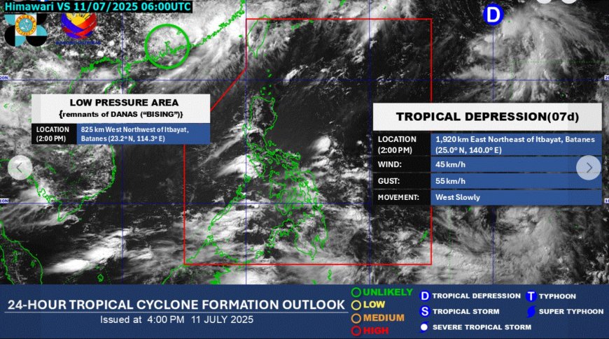
PAGASA confirmed that the tropical depression was situated 1,920 kilometers east northeast of Itbayat, Batanes as of 2 p.m. on July 11, 2025.
The low pressure area (LPA) previously monitored outside the Philippine area of responsibility (PAR) has developed into a tropical depression, according to PAGASA.
The tropical depression is characterized by 45 kilometers per hour winds and gusts of up to 55 kilometers per hour, moving westward at a slow pace.
Another LPA, a remnant of Tropical Cyclone Bising (international name: Danas), remains outside the PAR and is not expected to intensify into a tropical depression in the next 24 hours.
PAGASA's 24-hour public weather forecast indicates that the Southwest Monsoon or habagat will impact the country.
Intermittent rains are forecasted over Western Visayas, Negros Island Region, Palawan, and Occidental Mindoro, with potential risks of flash floods or landslides due to moderate to heavy rainfall.
Cloudy skies with scattered showers and thunderstorms are anticipated in Metro Manila, Mindanao, the rest of Visayas, Batanes, Babuyan Islands, Zambales, Bataan, Cavite, and Batangas, with possible flash floods or landslides during moderate to heavy rains.
Partly cloudy to cloudy conditions with isolated rain showers or thunderstorms are expected over the remaining parts of Luzon, with risks of flash floods or landslides during severe thunderstorms.
Sunrise on Saturday is set for 5:34 a.m.
According to the source: GMA Network.
What's Your Reaction?
 Like
0
Like
0
 Dislike
0
Dislike
0
 Love
0
Love
0
 Funny
0
Funny
0
 Angry
0
Angry
0
 Sad
0
Sad
0
 Wow
0
Wow
0


